Author Archives:

Alex Giannelia

Teamwork and Miracles

At 6:00 AM on August 12, 2014, a team of surgeons, doctors and medical practitioners converged at the Peter Munk Centre for Cardiology at Toronto General hospital to perform a complex open heart procedure which, seven hours later, resulted in me waking up with a new aortic valve to replace one which had been defective since birth. In addition, the surgeons repaired 8 cm of my aorta, and provided some electrical modification to my heart tissue to restore a regular pulse.

The surgery, which I still maintain is nothing short of a miracle, had been executed carefully by a team of consummate professionals for whom such work is routine. Ten weeks later, I was able to drive a car, engage in a full physiotherapy rehabilitation programme, and even resume occasional flight duties.

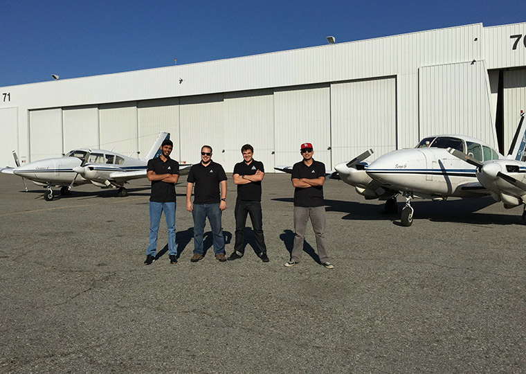
During my absence from the office, the team at ASC were also able to organize themselves as professionally as my surgeons and care workers at the hospital. Our busy summer flying season—one of the busiest in our company’s history—was able to continue without my direct intervention, as a result of incredible teamwork coming together in task sharing and precise operations.

From August to October, our aircrew flew and completed projects in far flung cities across North America: Victoria, BC; Baltimore, MD; Minneapolis, MN; Quebec City, QC; New York, NY and Deer Lake, NL—just to name a few! Within this continental operation, we took about 150,000 images without any reflights, and processed their associated positions and orientations all within a few weeks of completing each area. Flight projects were planned and executed and image products were delivered as routinely as we have always striven to provide.

Does this mean that I am now unemployed as a result of our team’s brilliant work? Well, I certainly hope not, as this remains one of the most exciting ways to make a living. I am proud to be setting new goals for our team as we move forward into the new year ahead.

Inasmuch as I am deeply and eternally indebted to the PMC team lead by Dr. Chris Feindel (click here to see what the operation looks like), Ms. Kelly McNabb and Ms. Veola Caruso for restoring my physical vitality, I am equally in debt to the team led by my wife and company Comptroller Elisabeth Giannelia, along with our Image Production Manager Peter Cimbron, Geomatics Manager Robin Poot, and Chief Pilot Jonathan Francoeur, for maintaining Airborne Sensing’s reputation for taking on and completing tough jobs against tight deadlines.

PXL-in-AZ


Double-Crew


Technological Expansion Once Again at Airborne!

For the last 33 years, we have always sought to offer our clients the most cost effective aerial survey products and services especially in the area of imaging technology. So, we were the first in Ontario to offer in-house colour printing, one of the first in Canada to offer kinematic GPS and IMU and the first in Canada to purchase a VEXCEL digital frame camera. We are expanding once again and this time into the area of airborne LiDAR with the acquisition of an OPTECH GEMINI system.

As one of the only companies in Canada who can offer simultaneous high density LiDAR and large format digital imagery, we are pleased to announce this new capability and expect to be fully operational by the end of July.

In December of 2012, we conducted a test of simultaneous high resolution digital imagery and low level LiDAR. We are well positioned to offer our clients the most appropriate survey tool for their projects. Furthermore, we are one of the few companies offering LiDAR using our own fleet of five aircraft. This capacity will minimize delays encountered when a LiDAR provider needs to coordinate with a platform provider. We can therefore maintain our standard quick response service on a coast-to-coast basis anywhere in North America.

So, after over 33 years of showing you the iridescent beauty of the earth’s surface, we are now getting a bit deeper.

1_Vexcel_GeneratedV2
This Digital Elevation Model (DEM) was derived from Vexcel UCX imagery taken at 4.5 cm

2_Lidar_GeneratedV2
This Digital Elevation Model (DEM) was derived from Riegl LiDAR data. For this test image, the LiDAR sensor was flown simultaneously with the above-mentioned Vexcel UCX.

Leaders in Versatile and Robust Geomatics Technologies

The precise, high quality aerial imaging provided by Airborne Sensing is combined with the latest advances in geodesy and photogrammetry in all our project designs to ensure that our completed projects meet or exceed client specifications. With over 20 years of experience in airborne GNSS post-processing, we boast complete project planning infrastructure, an in-house professional geodetic surveyor, direct georeferencing with our GNSS/IMU Position Orientation System (POS), automated aerial triangulation processes with manual oversight, geodetic ground survey capacities, and the creation of Digital Surface Models (DSMs) and orthophotos. We maintain scanning equipment to bring analog film products into digital image processing and photogrammetric environments.

radiomain1

Precise Positioning Experience
Over 20 years ago, Airborne Sensing conducted one of the first airborne GPS projects in Canada, which required the development of a camera interface that sends the mid-point of an exposure signal to the GNSS event-mark-file with an accuracy of 300 microseconds (2 cm). Eccentricity parameters between the antenna phase centre and the optical centre were measured with mm accuracy. Even with single frequency GNSS (then called GPS) technology, ASC proved that accuracies of less than 2 decimetres could be achieved with receivers as far as 400 kms away from the survey area.

Complete Project Planning
Airborne Sensing has established procedures for project planning to ensure that all delivered materials are consistent with client specifications, and our surveys are designed according to the use of active networks in the area and static GNSS observations. With Geographic Information Systems (GIS), we design project elements such as flight lines, project areas, airport bases, active GNSS stations, and existing geodetic control. GIS maps form the basis of photo control operations, flight operations design, and real-time project weather analysis. In consultation with the client, we use GIS to design the project with appropriate considerations such as targets and photo identifiable control. We consult with control and spatial referencing agencies (at the municipal, provincial and federal levels) to determine levels of accuracy available, and how these relate to the project specifications and we determine what active GNSS networks exist in the area (e.g. CORS, CACS, other Virtual Reference System (VRS) networks), computing transformations as requried. The geodetic and photogrammetric products are processed with the following programs: Applanix: Direct georeferencing Inpho: Aerial Triangulation observations BINGO: Aerial Triangulation Grafnav: Kinematic GNSS processing from airborne sensor with no IMU input Grafnet: Static GNSS network adjustments from GNSS base stations PPP: Precise Point Positioning to compute GNSS base station coordinates TRNX: Federal transformation software to transform reference frames from year to year NTV2: National datum conversion software Global Mapper/AutoCAD/Google Earth: GIS to develop map overlays.


Professional Photogrammetric and Geodetic Surveys
Our geomatics manager has over 20 years experience as a professional surveyor for engineering, geodetic and photogrammetric surveys of projects small and large, through North America, Latin America and the Caribbean. Trained in Germany, Canada and the U.S. and a registered Geodetic Surveyor with the Association of Ontario Land Surveyors (AOLS).

Direct Geo-Referencing and Aerial Triangulation
The GNSS/IMU Position and Orientation System (POS) used by Airborne Sensing was developed by the Applanix Corporation. The GNSS/IMU POS collects GNSS positioning data during flight at 1Hz or 2Hz, and IMU data at 200Hz. It measures the position of the camera relative to the centre of the earth to less than 10 cm, as well as the angle of the camera relative to the mathematical surface of the earth to slightly more than 1/1,000 of a degree. Output from this device is then post-processed using GNSS/IMU post-processing and filtering algorithms to compute the xyz coordinates and opk orientation of the camera at the time of exposure.

Looking Forward, Glancing Back

As we are rolling out our new and improved website, we are looking forward to engaging our friends in the geospatial community with multiple channels of information.  In our 34th year of business, we’ve seen a lot of changes in the way products get delivered to our client and the way their requests get to us, but then as now, the basic tenet has always been:  Our clients deserve the best service that can be offered in this field.  By this we mean on time completion of projects we take on, consistent imagery across the project area, delivery on time so you can get on with your mapping needs, all at a competitive price.

In the weeks ahead, we hope to be announcing even more variety in the technology we are capable of using to serve your needs, but regardless of the vehicle we use to deliver land data, the destination remains the same: YOUR SATISFACTION.

radiomain1


radiomain1