Category Archives:

Uncategorized

Arctic Adventure

This past fall, we had a true Arctic adventure. As a follow up to a combined photo and LiDAR survey of 14 villages in Nunavik, Quebec, we conducted a geodetic survey to verify our airborne data. As there are very limited commercially scheduled flights between these villages, we had to use our own aircraft to transport the crew from place to place. We then contacted the local authorities for access and logistical support – and as quickly as possible – collect the data for a network of survey points. On our prototype mission in Kuujjuarapik, we took 2 days to complete one survey. During this trip we managed to execute up to 2 surveys in one day including travelling from location to location.
As you can plainly see, the scenery was as bleak as it was awesomely beautiful. Here, north of the tree line with the first snows of winter, the raw and rugged landscape truly shows the brute origins of our planet. Ice scarred slopes of frozen lava giving witness to the most primordial of forces which have shaped this planet.
However, as you can also see from the one shot of Salluit, the tendency of village builders to show the world who they are is not restricted to Hollywood. Even the young lad in the picture can be seen in a previous blog post in front of that famous billboard, showing one more time how a career at Airborne leads to some of the most varied travel experiences imaginable.

Airborne Sensing featured in Wings Magazine

Airborne Sensing was recently featured in Wings Magazine. Read the complete article here.

Delivery Day: Our happiest moment


We love it when we have just delivered a successful project to a client. In this case, we conducted a project in the Caribbean for a large resource concern. Specifically, we provided aerial imagery; a control survey, and digital surface models so they can easily plan future infrastructure such as roads and buildings.
We love a challenge and projects like this give us great satisfaction because of the degree of difficulty and the multiplicity of challenges needed to ensure a successful outcome. In this case, negotiations took over 2 years; project definitions changed; we needed to get flight permits for the country in question and organize all phases of field work including surveying control points with the aid of local staff. Flying was also a challenge in that we could only deliver on clear sunny days and these are few and far between in tropical areas, so waiting is a big part of the game.
Finally on the photogrammetric side, determining the most likely “bare earth” surface when the terrain was heavily vegetated proved to be a significant challenge while ensuring client expectations for both budget and content were met. In the end – as the picture shows –this client was very happy with the result.

Opening in Quebec City

ABS_OpeninQuebec_main

It’s finally happened: The Airborne Sensing Corporation has arrived in la belle province of Quebec, fulfilling a dream long cherished by Alexander Giannelia. Our new office – a subsidiary of our Toronto base – is located at Jean-Lesage International Airport. More precisely, we can be found at 611 Avenue 6 de l’Aéroport, Québec, QC, G2G 2T4.Great.

As always, we will provide the same rigour and determination– the foundation of ASC’s reputation – as we help you with on your aerial acquisition projects that you have come to expect from Airborne Sensing. In Quebec and beyond, we are here to ensure that all of your projects are completed on time and on budget.

Give us a call, we look forward to serving you.

Soirée Champlain 2015

ABS_SoireeChamplain_01

The annual event of the Champlain section of the Canadian institute of Geomatics (CIG) was held Thursday, March 12 at the Ice Hotel in Quebec. This has been a tradition for the past 10 years for the Champlain section of the CIG, and provides an excellent occasion for geomatics professionals to meet one another and discuss the state of the industry.

The evening began with a tour of the location, with a technical explanation of the design of the Hotel and all of the ice accessories. The interior spaces have an ambient temperature of -5 degrees Celsius, regardless of the outside temperature.

Following the tour, the President of the Champlain section, Annick Jalon, presented a retrospective of 2014 and the 2014 GeoCongress. During her presentation, she thanked all partners and participants of the GeoCongress. Subsequently, a cocktail was served in an ice glass, and soups and sandwiches were served to all guests.

The Soirée Champlain provided a perfect opportunity to meet people in the Geomatics industry and to promote the imminent establishment of the Airborne Sensing Corporation’s new office in the city of Quebec. Michel Dionne

ABS_SoireeChamplain_02

ABS_SoireeChamplain_03

ABS_SoireeChamplain_04

Airborne Sensing at the AOLS AGM

At the end of February every year, the Association of Ontario Land Surveyors gathers for their Annual General Meeting. This year, Alex and Robin went up to Huntsville, ON to rub shoulders with the top brass of the AOLS, and, of course, to refresh friendships in the industry. Conferences like this are an ideal opportunity to explore what is happening in the field, to catch up with colleagues and make new friends, and determine how to position Airborne Sensing for the future.

The AOLS is an association with a long history using classical techniques of land surveying. As such, it was great to hear about the great interest in new technologies. Robin was pleased to note the shift toward more innovative techniques in land surveying, as well as opening up to diverse perspectives in the field.

As the new president of the Canadian Institute for Geomatics, Alex led a group discussion of the future goals for Canadian professionals in the surveying business. This was an exciting nexus of new and seasoned professionals eager to work together to promote geomatics in Canada and beyond. As a country once bemoaned for having “too much geography and not enough history”, the mapping industry in this proud nation continues to march forward.

While we missed them here in Toronto, we got to see some pictures of the gorgeous scenery in Huntsville!

ABS_AOLS_Blogpost

Accessing Restricted Airspace

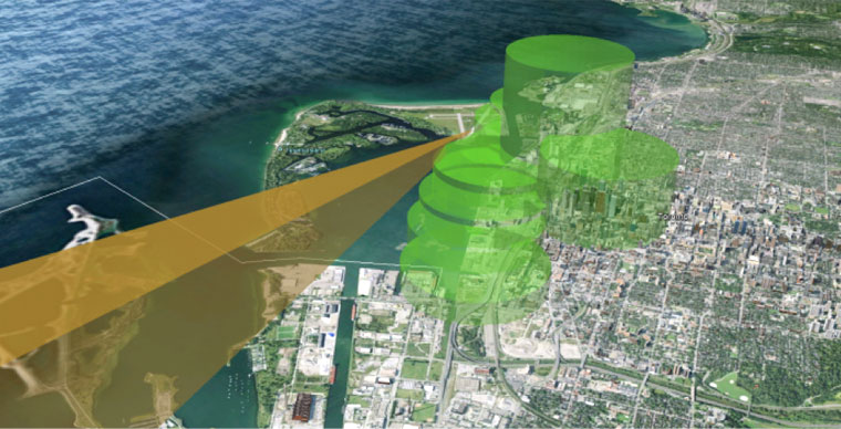
Whizzing by the restaurant deck of Toronto’s CN Tower at 120 knots in a Piper Navajo – the culmination of two months of preparation for a 15-minute project – paid off in spades. Flying this close to urban obstacles is generally not permitted under existing air regulations. Airborne Sensing routinely obtains permits from the governing authorities while ensuring that your projects are carried out safely and unobtrusively. The working in and out of restricted airspace is fascinating inasmuch as the very real regulatory boundaries only exist in virtual space. The image here shows a rendering of the restrictions near Toronto’s waterfront, where the approach path to the City Centre Airport is shown in 3D, along with the geospatial relationship to the regulatory restrictions preventing aircraft from flying too close to the buildings in the downtown core.

AccessingRestrictedAirspace_01_toronto

Such a rendering makes the obstruction zones obvious, but this virtual space must be respected without actually seeing this 3D space. As a pilot, I have been trained to read and follow aeronautical charts, which are developed to keep aircraft out of restricted airspaces. The restrictions include physical structures and political boundaries. To provide another concrete example, the following chart depicts the airspace around El Paso, Texas. In order to provide imagery of the city of El Paso, the flight area would extend past the municipal boundary and across the Mexican border. In order to provide such imagery, Airborne Sensing, like any other aviation company, must apply to the Mexican government for the appropriate permits, a process that can take months to complete.

AccessingRestrictedAirspace_01_elpaso
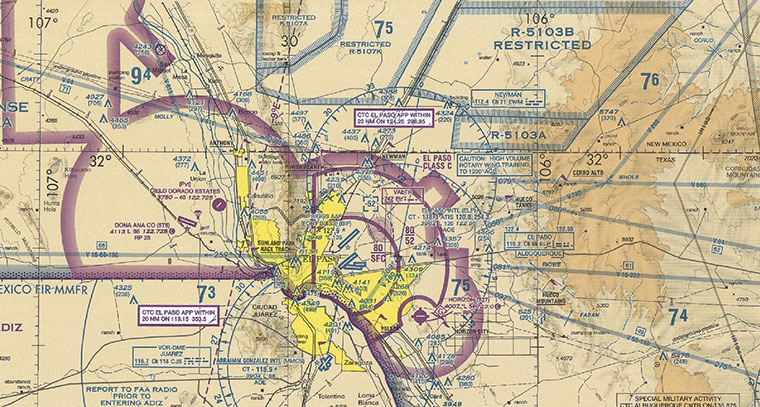
This aviation sectional of El Paso, TX, shows the Mexican border to the south west. The city limits of El Paso, shown in yellow, continue right to the edge of that border, demanding very careful navigation and communication on the part of our pilots.

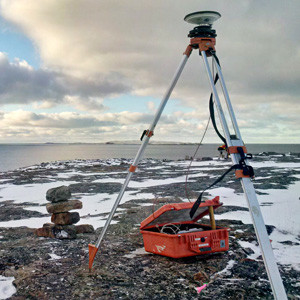
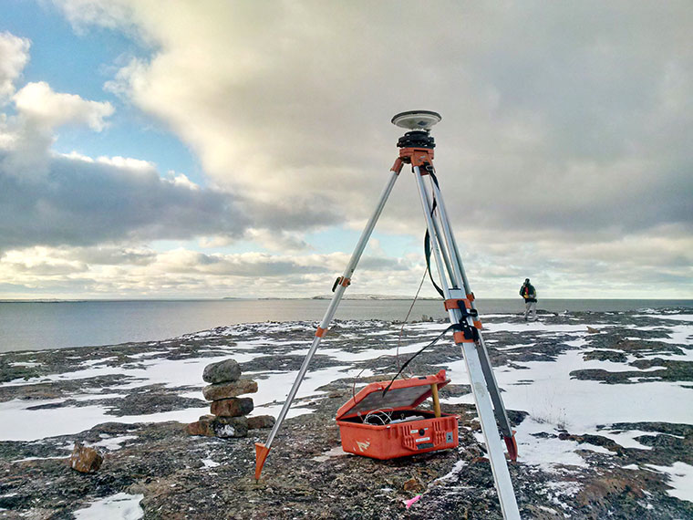
Suffice it to say that our clients are interested in getting the job done on time and on budget. They rely on us to obtain whatever kind of access is needed. Airborne Sensing’s expertise in gaining access to restricted airspaces can be a critical piece of the puzzle when it comes to ensuring your projects are completed within your specifications. In addition to following established procedures to gain access to these restricted airspaces, ASC puts a considerable amount of effort into training our crews. This extra effort ensures that they conduct themselves professionally, once they have gained access to those spaces. As the closing speeds of aircraft to airspace boundaries can be as high as 450 km/hr, communications and movement procedures need to be precise. Airborne Remote Sensing is acknowledged as one of the most benign and unobtrusive means of studying and measuring the earth’s surface. At ASC, the background work that we do to make things work for you is part of how we aim to keep it that way.

AccessingRestrictedAirspace_01_phoenix2

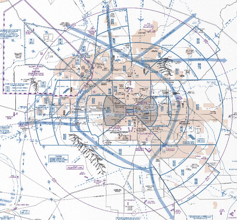
The area around Glendale, AZ is another excellent example of the multiplicity of restrictions that can exist and overlap in an airspace. Here, pilots must be aware of the White Tank mountains to the west of the airport, a student jet training area off the end of the runway to the north, and Litchfield stadium (the site of this year’s Superbowl) to the east, each of which can offer a variety of challenges to our aircrew.